Cathkin Braes C P map
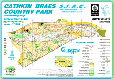
Cathkin Braes
Information
When combined with the adjacent “Big Wood”, this area provides the most challenging orienteering available within the City.
Due to extensive new mountain bike tracks the area needs to be remapped. Possibility of adding on Ferniebrae Meadows to the NE.
New permanent course relaunched in 2017 and still 100%.
SMARTPHONE Courses also available.
Further resurveys required due to extension of Mountain Bike Facilities.
The area was first mapped in the 1970s by Mr.J.W.Baillie, Geography Teacher from Cathkin High School.
Since then it has been remapped on 3 occasions.
12 controls make up the new permanent course. With tussocky terrain,
stout footwear is advised. Walking time for the course is approximately
60 minutes.
Venue for the 2014 Commonwealth Games Mountain Biking Event.
Cathkin Braes CP - 12 posts. 100%. Tough terrain around Posts 1 & 2 - full leg cover required.
Park History:
Presented to the City in 1886 by Mr.James Dick and in accordance with
his wishes, the Park has been left in its natural beauty. Every part is
open to the public to roam about at will.
Course spans the west end of the Braes including Big Wood.
Highest point is Queen Mary’s Seat, about 600ft. above sea level.
Watch for diving skylarks on the grassland to the west.
Extensive views across the City of Glasgow and beyond.