| Map name | Near | Info | Map |
|---|---|---|---|
| City of Glasgow Area | |||
| Alexandra Park | Glasgow G31 | With the closure of Golf Course, the venue held Race 2 in both the 2021 and 2023 GPC. The park was used for training in the formative years of STAG. Although small by day, by including the golf course it becomes a fine venue for night events. Plans for new permanent course coming along and hoping to be available from May 2024. |
|
| Alexandra Park and Milnbank (East) | Produced March 2023 for Dark Park Event. |
||
| Bellahouston Park | Glasgow | Permanent course not operational. SMARTPHONE Courses available. |
|
| Carntyne & Greenfield | Glasgow G32 | Urban map. Surveyed & drawn by Terry, June 2018 |
|
| Castlemilk Park | Glasgow | STAG advised on this map production way back in 2006 but its use appears to have stalled due to a cut in Community funding. |
|
| Cathkin Braes & Fernbrae Meadows | Glasgow | Remapped by Rudi Paul, December 2022 |
|
| Cathkin Braes C P | Glasgow G73 | When combined with the adjacent “Big Wood”, this area provides the most challenging orienteering available within the City. Due to extensive new mountain bike tracks the area needs to be remapped. Possibility of adding on Ferniebrae Meadows to the NE. New permanent course relaunched in 2017 and still 100%. SMARTPHONE Courses also available. |
|
| Craigend | Housing Estate to the east of Hogganfield Loch |
||
| Craiglang, Townhead | Sprint map produced in 2022 of area between GCU and GRI |
||
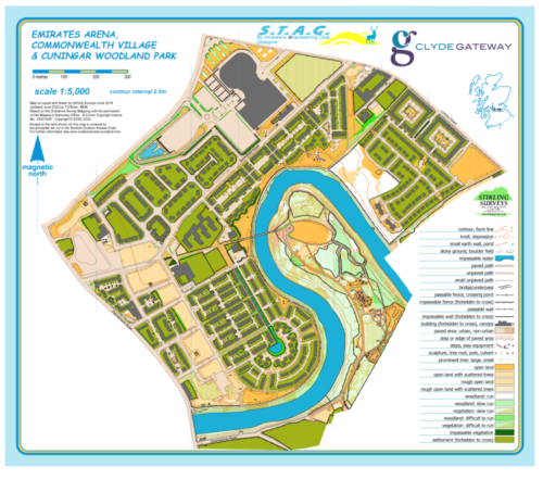
| Cuningar Woodland Park | Glasgow | Created with support from Clyde Gateway Project and currently being extended. Hopefully a venue in our Saturday Afternoon Autumn Series, SMARTPHONE Courses available. |
|
| Dawsholm Park | Glasgow G20 | Dawsholm Park could well be described as ‘the nature lover’s park’ as there is much of interest to the nature enthusiast here. Large areas of the park have been left in a natural state. New permanent course launched 2017 and 100% intact as of December 2020. SMARTPHONE Courses available Spring 2021. |
|
| Dawsholm Park & Garscube Estate | Glasgow G20 | The 2 adjacent areas combined but limited use. |
|
| Dechmont Ranges | Cambuslang | Plans to remap are now on hold due to sale of land for housing. |
|
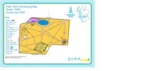
| Elder Park | Elder Park | First used in May/June 2018 for an introductory orienteering activity for Pirie Park & St.Constantine’s Primaries respectively. SMARTPHONE Courses available. |
|
| Emirates, Comm Village & Cuningar | With support funding from CLYDEGATEWAY. SMARTPHONE Courses available. |
|
|
| Garscube Estate | Glasgow | Joint copyright with Glasgow University. Limited use due to access issues. |
|
| Glasgow Caledonian University | Glasgow | Inspired by Professor John McKendrick......... |
|
| Glasgow City Centre | Glasgow G1 | Urban map. Surveyed & drawn by Terry . First used in May 2014. |
|
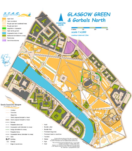
| Glasgow Green | Glasgow G40 | STAG’s use of this park has been limited to summer evening events. New map to ISSprOM standards in February 2020. The permanent orienteering course here utilises the historic nature of the area with no additional markers being installed. SMARTPHONE Courses available. |
|
| Greenfield Estate and Park | Produced February 2023 at Sprint specification for STAG Training. |
||
| Hogganfield Loch | Glasgow G33 | Development of Lethamhill Golf Course has limited access. STAG’s only use of this area has been for Night Events but as the area has a magnetic appeal to Glaswegians. There is a permanent orienteering course here. SMARTPHONE Courses available early 2021. |
|
| Kelvingrove Park | Glasgow G3 | First used by STAG in 1989, the area is a regular on the “Come & Try” circuit. In 1999, the Park World Tour held an event in Kelvingrove which attracted the World’s Elite orienteers to Glasgow. The permanent course utilises the history of the park as there are no additional markers, only the permanent features to navigate to ! SMARTPHONE Courses available - 3 options. |
|
| King's Park | Glasgow | King’s Park was first used once by STAG back in 1985, when an event for primary schoolchildren was held as part of The International Youth Year. A small but interesting area which can provide a challenge for everyone. Area needs remapped. There is a permanent orienteering course here. SMARTPHONE Courses available Autumn 2021. |
|
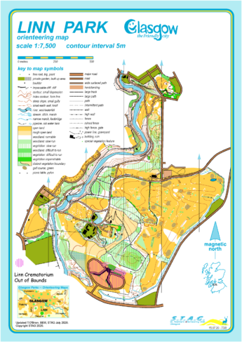
| Linn Park | Glasgow | Parkland split by the White Cart Water adjacent to Linn Park Golf Course. Glasgow’s 2nd largest park was mapped in the mid 1980s and features regularly in STAG’s programme of events. There is a permanent orienteering course here. SMARTPHONE Courses available. |
|
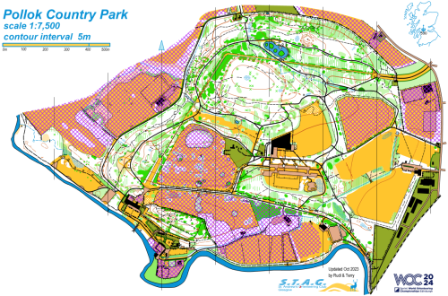
| Pollok CP |
|
||
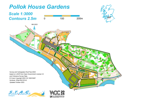
| Pollok House Gardens | Glasgow |
|
|
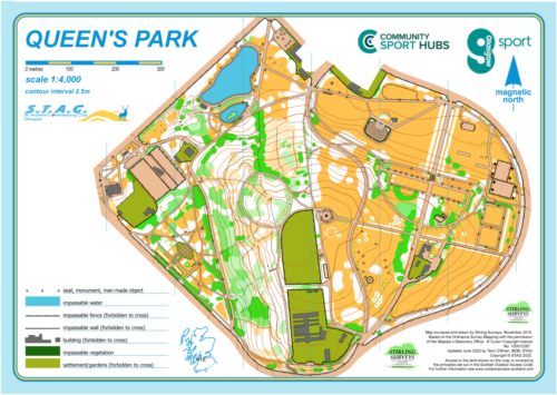
| Queen's Park | Glasgow | First used in 1989, this park may be small in size but it provides a variety of orienteering challenges due to shape and mixed terrain. There is a permanent orienteering course here. SMARTPHONE Courses available. |
|
| Ruchill Park | Glasgow | Due to the building of Ben View School Campus the reduced park size has meant that a permanent course is no longer viable. |
|
| Springburn Park | Glasgow | The area was mapped in the mid 1980s as a STAG Junior Project and was included in the first Glasgow Parks Summer Series in 1989. Another small park but with a variety of terrain it offers a good challenge. There is a permanent orienteering course here. SMARTPHONE Courses available Spring 2021. |
|
| Springburn Park Sprint Map | In preparation for use May 2023 |
||
| Summerston Estate, Glasgow G23 | Glasgow | Urban map surveyed & drawn by Terry in 2016. |
|
| The Hurlet | Rudi's first map from scratch ; debuting April 2023. |
||
| Tollcross Park | Glasgow | Tollcross Park was the first Glasgow Park mapped by STAG back in 1982 and played a vital part in the early development of the Club. There is a permanent orienteering course here. SMARTPHONE Courses available. |
|
| Victoria Park | Glasgow | As part of The International Youth Year of 1985, STAG extended the Glasgow Primary Schools Festival to 4 venues, one of which was Victoria Park. |
|
| Victoria Park and Broomhill | Sprint map in production for launch in May 2023. |
||
| Whitecrook, Clydebank | Clydebank | Mapped by Arnis and used for DP & Spring 1 in 2019. |
|
| Wyndford | Updating of 2013 map produced for John Paul Academy by Terry |
||
| Motherwell Area | |||
| Allanton - Kingshill | Shotts | New Area - also known as Redmire Loch, Allanton. Revisited December 2021 and discussions with NLC ongoing but parking still to be resolved. March 2024 - No progress. |
|
| Cambusnethan and Carbarns | Gowthraple | First used Spring 2018 and it was a very wet evening. |
|
| Chatelherault, Hamilton | Hamilton | Avon Gorge & Deer Park was originally mapped in 1990. Limited use due to clear felling on west side & landslip near “The White Bridge” which was due for repair in 2017 but still incomplete as of April 2023. |
|
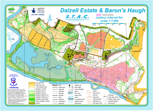
| Dalzell Estate and Baron's Haugh | Motherwell | Just along the River Clyde from Strathclyde Country Park. First use of new map January 2014. Limited access due to presence of RSPB reserve. Projected use of Dalzell Estate in January 2023. |
|
| Greenhead Moss, Wishaw | Wishaw | Situated to the south-west of Newmains & north-west of the village of Waterloo, Greenhead Moss is a cracking wee area with a terrific mix of terrain & old mineworkings. |
|
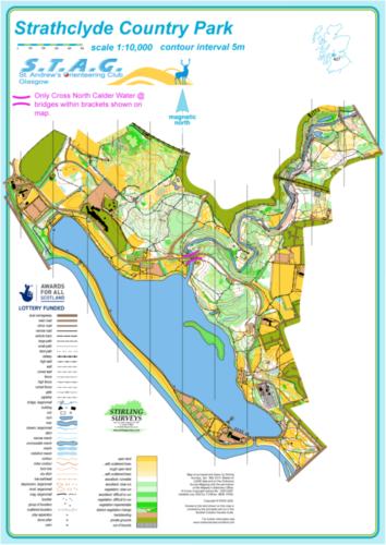
| Strathclyde Country Park, Motherwell | Motherwell | New map jointly funded by STAG & North Lanarkshire Council. |
|
| Highland Perthshire Area | |||
| Allean Forest, by Pitlochry | Pitlochry | Area was revisited in late 2023 to decide whether to remap or not. Decision pending. |
|
| Bonskeid Estate, by Pitlochry | Pitlochry | Joint copyright with ESOC. |
|
| Dalnamein, by Blair Athol | Blair Atholl | First mapped in 2002 the area provides a terrific mix of terrain. In the frame for Scottish Relays 2023 but A9 Dualling Project may mean access isn't possible. West side checked early February 2022 and little storm damage. |
|
| Errochty, by Blair Athol | Blair Atholl | In March 2020, Errochty hosted the Compass Sport Scottish Final which turned out to be the final O Event before Covid-19 restrictions kicked in. Next projected use February / March 2022. |
|
| Faskally Woods, by Pitlochry | Pitlochry | Must still be one of STAG’s best investments & a favourite for most orienteers. |
|
| Grandtully, by Ballinluig | Grandtully | Map produced for STAG’s 35th Anniversary Event in 2017 and was used for 6th Day of Strathearn 2019. |
|
| Leachdann Tom na Croich, by Pitlochry | Pitlochry | Extension of Allean map to the west. Further recce being carried out during 2021. Required to supplement Bohally Wood map for Junior Courses. |
|
| Linn of Tummel, by Pitlochry | Pitlochry | Joint copyright with ESOC. Parking proving incredibly difficulty. |
|
| East Kilbride Area | |||
| Calderglen Country Park | East Kilbride | Area is being remapped for an Autumn Event in 2024 |
|
| Redlees LNR | Glasgow | ||
| Strathaven Market Town | Strathaven | STAG’s 1st Urban Map last used in August 2012. Projected Saturday Autumn Afternoon Event in Autumn 2022. SMARTPHONE Courses are available. |
|
| Cumbernauld and Kilsyth Area | |||
| Cumbernauld Community Park | Cumbernauld | Mapped in Spring 2017 & a welcome addition to local areas. Part of Spring Series 2022. |
|
| Cumbernauld Park, Crow & Dunns Woods | Cumbernauld | This area is managed by NLC & SWT and has increased in popularity since it was first mapped back in early 2000s. Use of Cumbernauld Park itself possible in Autumn 2022. |
|
| Kildrum Estate, Cumbernauld | Cumbernauld | STAG’s second venture into Urban Orienteering. |
|
| Northside Woods, Cumbernauld | Cumbernauld | Northern section of our enormous Cumbernauld Town Urban Map adjacent to M80. Being used for joint STAG/FVO Evening Event in May 2022. |
|
| Palacerigg Country Park, Cumbernauld | Cumbernauld | STAG’s 1st ever formal competition was held in February 1984 at Glencryan which forms the NW corner of the map. The existence of Palacerigg CP was a well guarded secret 38 years ago! This park is undergoing redevelopment and STAG hope to continue our successful partnership with NLC. |
|
| Ravenswood LNR, Cumbernauld | Cumbernauld | The NW corner of the Cumbernauld Town Urban Map adjoining to Northside Woods. Being used in Spring Series 2022. |
|
| Monklands Area | |||
| Drumpellier Country Park | Coatbridge | Located to the North West of Coatbridge and to the east of the M73, this wee gem of an area has only improved over the years. There is a permanent orienteering course here. SMARTPHONE Courses available - 3 courses. |
|
| Other | |||
| Girvan | Girvan | 1st use for SOUL September 2021. |
|
| Parkhill Wood, Lochwinnoch | Paisley | An area which was mapped way back in early 2000s by Pat Flanagan has been revitalised! |

|
Mapped Areas
Updated 13th March 2024
Our Maps page shows all the areas we have mapped for orienteering, and is a record of the maps that have been professionally printed and either produced by Terry O'Brien BEM, Arnis Saltums, Fredrik Nordvall Forsberg, Rudi Paul or by Stirling Surveys, Peel Land Services ; Deeside Orienteering and Leisure Maps, Graham Gristwood.. Select a marker to show its details.
All maps listed are Copyright STAG and it is illegal to photocopy for use. Maps, with or without a permanent course can be purchased from the Club for a fee that includes a royalty charge & printing costs. Discount rates are available for large quantities, to affiliated Groups and STAG Members - price on application to info@stag-orienteering.co.uk.