Glasgow Parks Race 1 - No.631Cuningar Woodland ParkSun 02 December, 2018

Local level event
Explanation of Event levels
Local events are usually low key and in the 'localised' area, ideal for newcomers to try the sport and Activities are non competitive events used for training and coaching, aimed at members of the club, but they can attract people from neighbouring clubs, and are often ideal for newcomers to try the sport. Regional events attract participants from around the local Region, National events are high quality competitions that will attract people from far away, Major events are Major Events such as a British Championships.
Results
Location Info
Near: Rutherglen G40 Lat,Lng: 55.83705,-4.20627 OS Grid Ref: NS625626
Open an interactive map in:
GoogleMap -
Streetmap (OS 50k)
OpenStreetMap -
BingMap (OS 50k)
Pre Event Info
This Race shall see the first use of STAG’s Brand New Map - funded by CLYDEGATEWAY - of the Commonwealth Village & Cuningar Woodland Park.
Entries now closed. Start times shall be posted here.
Gpc 2018 Race 1 Information Cv And Cuningar As Of Tues 27Th Nov2018
Loose Control Descriptions now available to download below (6:20pm on Thursday 29th November 2018.)
Please note Control 37 on your maps show CD as "Tree- SE Side" ; corrected CD is "Copse-SE Side" as in this download.
No loose CDs shall be supplied by the Organisers.
Directions / Parking
I am having to change the parking arrangements as an estimated 50 / 60 cars could be arriving on Sunday & the New Cuningar Car Park can only take 35 cars at a push.
As a result the REGISTRATION CAR shall now be parked on Downiebrae Road (where the pin is on the Google Map) at the pedestrian entrance to the Cuningar Woodland Park.
If travelling from The East
Turn off the M74 at Exit 2 then turn RIGHT onto the A724 to Farmeloan Cross* where you turn RIGHT onto Dalmarnock Road. Downiebrae Road is the only RIGHT HAND TURN after you pass the Retail Park (TESCO with Costa Coffee, KFC & McDonalds plus toilets) on the LEFT. If you miss the turn off you will have crossed over the River Clyde.
If travelling from The West via M74
Turn off the M74 at Exit 1A & turn LEFT then RIGHT onto the A730; keep Shawfield Stadium on your LEFT and continue along the A730 pass under the M74 & turn LEFT onto B768 (Rutherglen Main Street) ; turn LEFT at the next Main Set of Lights onto Farmeloan Road; Pass back under the M74 & reach Farmeloan Cross, take 2nd LEFT onto Dalmarnock Road then as above *
If travelling from Glasgow City Centre you need to navigate your way onto Dalmarnock Road & on crossing the River Clyde turn sharp LEFT onto Downiebrae Road.
When parking on Downiebrae Road should park on either side of the Road as required - most shall park beyond the pedestrian entrance - & then check in at the REGISTRATION CAR on arrival. By following the above instructions your vehicle will be facing the best way to travel to Tollcross Park / Race 2 venue.
Distances from REGISTRATION CAR
To Portaloos (x4) - 450m.
To Start & Finish - 500m.
To Isolated Finish - 1300m.
The Play Park should be treated as "Out of Bounds" for free play until after your run - weather permitting.
Map / Terrain
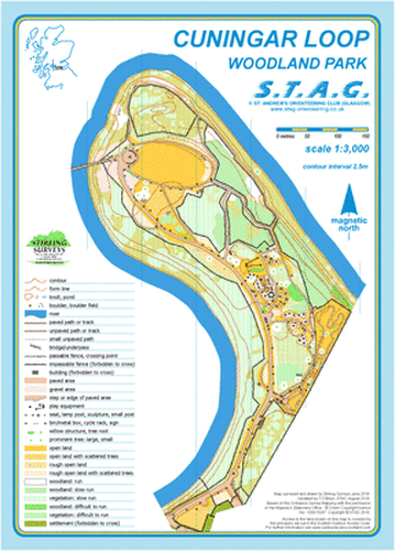
Social & Junior competitors shall use an A4 map - Scale 1:3000 of the Cuningar Woodland Park only.
The symbols used for this map are from BOF Template for schools maps. Planner - Terry.
All others shall use an A4 map - Scale 1:4000 of The Southern Commonwealth Village & Cuningar Woodland Park.
This involves Urban
Sprint Orienteering within the Village & crossing over the new
footbridge across the River Clyde to access the Village & again
return to Cuningar Woodland Park.
Map surveyed & drawn by Stirling Surveys September 2017 & updated by Terry November 2018.
Please note that the map drawn by Stirling Surveys has to conform with ISSOM spec. However I have added in some features from the 1:3000 map although none of these are used as control sites eg Tall Metal Sculpture at eastern side of footbridge.
Seats & Benches are NOT shown on the 1:4000 version.
Please retain your map but do not show it to others before their run or discuss openly your course.
Registration and Start times
Starts from 10am with registration open from 9:15am.
Course Information
There is 1 Start but 2 Finishes to achieve suitable course lengths.
All Hyper, Ultra, Super & Veteran Womens Courses finish on the Commonwealth Village side (West side) & should then walk back to your car.
The majority of the sites on the Cuningar side shall use Sportident fibreglass stakes / SI Unit with the Code Number shown only on the Unit itself.
On the Commonwealth Village side most SI Units will be cabled & padlocked to the Tree or Fence being used. Competitors are advised to grab the SI Unit & pull until the cable goes tight so that the SI finger can be dibbed correctly . This obviously doesn't apply to those using SIAC Cards.
Download for Race 1 shall take place on your arrival at Race 2 within the Education Room of Tollcross Park.
Entry Details
As shown on SI entries website
Dog restrictions
On leads at all times.
Miscellaneous
As the parkland terrain is minimal & the vast majority of paths are paved, a flat running shoe is recommended. Dobs or Metal Spikes are not allowed.
The bridge over the River Clyde has a solid wooden post at each end please take care when crossing as it could also be slippy in wet/cold weather.